Gansu · Gannan
Yeliguan: A Small Gate on a Wide Seam
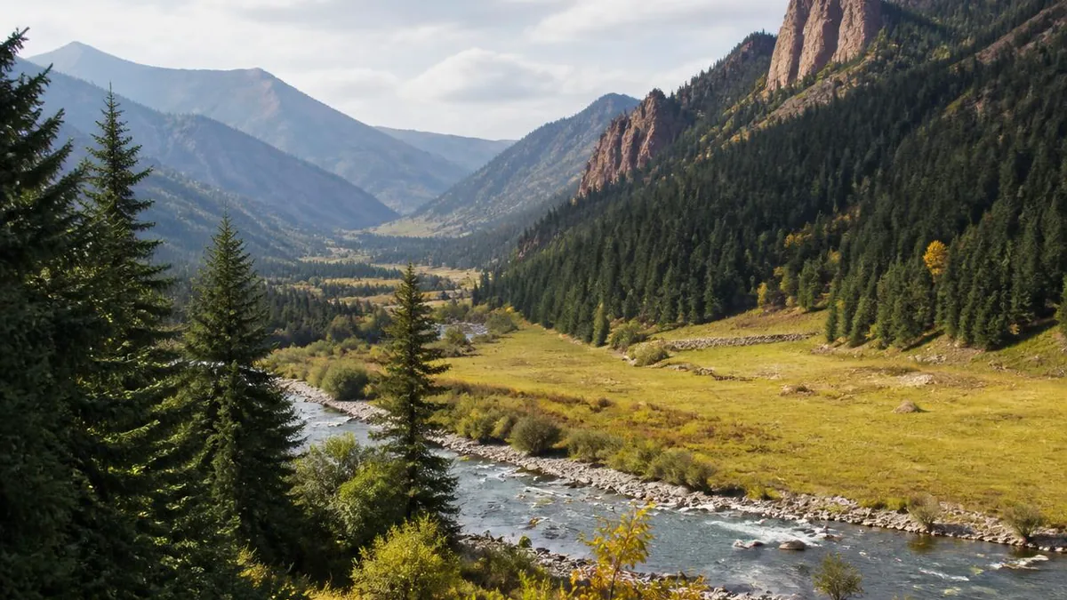
Gansu's newest 5A area encloses about twenty square kilometres of red rock and one landslide lake. Almost everything that makes this corner of Gannan unusual sits outside the ticket line, and most of what is written about it is younger than the rating.
5A View location, maps and nearby scenic areasYeliguan became a national 5A tourist area on 26 December 2024. That single fact explains most of the difficulty in writing about it honestly.
The Ministry of Culture and Tourism notice, numbered 2024-100, confirmed nineteen sites that day; the Yeliguan Tourist Area, in Lintan County, was the entry for Gansu, and it became the first 5A area in the Gannan Tibetan Autonomous Prefecture. Almost everything published about the place in the years around that decision was written to support or celebrate it. There is very little scholarship, and the official record is thin on exactly the details a visitor wants.
So this guide does something slightly unusual. It treats the boundary itself as the subject. The rated area is small — 20.2 square kilometres — and the reasons this pass is interesting are mostly outside it.
What the 5A boundary actually encloses
The rated area is described consistently as two linked units. Chibi Yougu, the red-cliff canyon, sits west of the town of Yeliguan. Tianchi Yehai, an alpine lake, sits to the north. Together they are given as 20.2 square kilometres, which is roughly the footprint of a small district, not of a mountain range.
The site’s designation history is longer than the 5A rating suggests. It has held a 4A rating since the mid-2000s — county material gives 2005 and other accounts give 2006 — and was named a national geopark in 2014. It passed the 5A landscape quality review in 2023 and went to public notice from 13 to 19 December 2024 before the formal announcement a week later. News and promotional material also lists national forest park, national water conservancy scenic area and national sports tourism demonstration base status, which are separate designations from separate ministries and are not all coextensive with the 20.2 square kilometres.
The application itself left visible marks. County reporting describes a total infrastructure programme of 278 million yuan, of which 120 million had been spent by the time of writing, covering a visitor centre, car parks, a boardwalk at Miaohuashan, lakeside facilities, town lighting and a laser show on the hillside. Twenty-two guides were hired in one intake. If a boardwalk or shuttle arrangement you read about seems newer than the guidebook you are holding, it probably is.
A pass on the seam between two plateaus
The geographic description that gets repeated is the one worth keeping: this is the transition zone between the northeastern margin of the Qinghai-Tibet Plateau and the Loess Plateau, on the western end of the Qinling fold belt.
That is not scenery language. It is the reason for almost everything else. Elevation here is given as above 2,200 metres, high enough for subalpine meadow but low enough for terraced grain farming on the same slopes. Grazing and cultivation interleave rather than replacing each other. The vegetation changes with a few hundred metres of climb.
The human geography follows the same seam. Lintan County covers 1,393.47 square kilometres and recorded 127,387 residents in the 2020 census. It sits inside a Tibetan autonomous prefecture, but reference material records Tibetan Buddhist, Muslim and Christian communities in the same county seat, with the Han population including families who identify as descendants of Ming garrison households. Historically the pass functioned as a staging point on the Tang-Tubo road and later the tea-horse trade.
A pass is a place where two systems meet and neither wins. That is the honest description of Yeliguan, and it is more useful than any of the epithets in circulation.
Red sandstone, and how much of it you actually walk
Chibi Yougu is Danxia: red terrestrial clastic rock, cemented by iron and carbonate, cut by joint systems and then shaped by weathering, gravity failure and running water. The colour comes from oxidised iron in the cement, and the vertical walls come from the joints, not from the bedding.
What makes this particular canyon different from the better-known Danxia country further northwest in Gansu is water. The gully carries a stream, and local descriptions count springs along it — a figure of seventy-two is often quoted, in the way that Chinese landscape descriptions use seventy-two to mean “many” rather than as a census. The result is a red canyon with dense vegetation in it, which is not what most visitors arrive expecting.
Be careful with the length figures. The canyon is described as running up to 20 kilometres into the hills, with only about two kilometres developed for visitors; a separate account gives the walked route as roughly three kilometres and about ninety minutes. Those are compatible if one is measuring the geological feature and the other the boardwalk, but the practical number is the small one. Plan a half-day here, not a trek.
A lake behind a landslide, and ice read as an omen
Tianchi Yehai is a barrier lake — impounded by a landslide or debris blockage rather than by a moraine or a dam. Descriptions place it around five kilometres north of the town, give a length of about five kilometres and a surface elevation near 2,610 metres, though the elevation figure comes from tourism material rather than a survey and should be held loosely.
The lake’s distinctive feature is winter, not summer. When it freezes, the ice develops patterns that local tradition names and reads, and this is old enough to appear in the traditional list of Taozhou’s scenic sights. Accounts describe residents examining the ice on the eighth day of the twelfth lunar month and reading the figures in it as a forecast of the coming harvest.
That is the second time in this article that a natural phenomenon gets used as an agricultural oracle, and the pattern is worth noticing. In a place where farming happens at the top of its viable altitude, divination attaches to whatever is measurable and annual.
Practically, the lake has more than one entrance, described locally as separate lake and temple gates. Which one is operating, and whether boats are running, changes.
Chang Yuchun, who was probably never here
Beside the lake stands a temple locally called Changye Temple, and the lake takes an alternative name from it. The figure honoured is Chang Yuchun, one of the founding generals of the Ming.
Handle this carefully. The documented military event in this county is the campaign of 1379, the twelfth year of the Hongwu reign, when the Ming court responded to a revolt by the eighteen Taozhou tribes and dispatched a force credited in the Ming Veritable Records to Mu Ying, with Jin Chaoxing and Li Wenzhong. That campaign established the garrison and rebuilt the town. Chang Yuchun is not the commander in that record.
What exists instead is a local devotional system. Accounts of Lintan describe eighteen of the Ming founding generals venerated locally as dragon gods, each with a temple, distributed across the townships, with a well-known fair at Xincheng. In other words, the naming of this lake is evidence about how a garrison population remembered its origins, not evidence that a particular general watered his horses here. That is a more interesting fact than the legend, and it is the one that can be checked.
The Tao River, and where it ends
Lintan lies in the basin of the Tao River, and the Tao is the thread that ties this article to the rest of Gansu.
The river rises in Henan Mongol Autonomous County in Qinghai, between the eastern flank of the Xiqing mountains and the Min mountains, and runs about 673 kilometres through a basin of 25,527 square kilometres, passing Luqu, Lintan, Zhuoni, Min, Lintao and Yongjing. Mean annual runoff at the Goumencun gauge is given as 5.3 billion cubic metres, which makes it the second-largest tributary of the upper Yellow River by volume after the Wei, and Gansu’s third-largest river. Unusually for the region, it carries a lot of water and comparatively little sediment.
It does not join the Yellow River in open channel. It ends in the Liujiaxia reservoir — the same body of water you cross by boat to reach Bingling Temple, several hours’ drive north. The dam is described as spanning both rivers, and the Tao’s sediment fan reaches to within about 1.5 kilometres of it, which is why a dedicated sand-flushing tunnel facing the Tao mouth was begun in 2006.
At the pass itself the water you actually see is the Yemu River, the stream that runs past the mouth of Chibi Yougu and carries the local rafting operation. Reference works’ tributary lists for the Tao do not name it, so treat the local hydrology as locally described rather than formally catalogued.
A Ming garrison town, in the same county
Thirty minutes of this county’s history explains more than an afternoon in the canyon, and it is at Xincheng, the old county seat.
Taozhou Wei city is a walled garrison town described as the largest surviving wei city in China. The measurements are specific: a circuit of 5,430 metres, walls 9.9 metres high, 7.92 metres thick at the base and 6.6 at the top, a moat 5 metres deep and 4 wide, 2,050 crenellations, 16 wall projections, 9 corner platforms and five named gates. The enclosure covers 2.98 square kilometres, split by an internal cross-wall into a flat front town of roughly two-thirds and a hill town behind, with the northernmost wall running along a ridge nearly 300 metres above the plain.
The layers underneath are older: a Han-period town, rebuilt in 481 by a Tuyuhun ruler under a different name, a route town under the Tang, and only then the Ming reconstruction after 1379. A soviet was established here during the Long March in 1936.
The reason it survives is bureaucratic. The county seat moved away in 1953, and the walls consequently escaped both the demolition and the building that reshaped active county towns. Only one of the main gates is relatively complete; the other three survive as barbicans. It was listed as a national key protected site in 2013. The magnitude 6.6 Minxian-Zhangxian earthquake that same year opened 26 cracks and six collapses in the walls, with 510.4 cubic metres of fallen material recorded.
Ten thousand people on one rope
Lintan’s best-documented living tradition is a tug of war, and it is a national intangible cultural heritage item — added in 2021 in the fifth batch, after provincial listing in 2006.
The format is fixed. On the fourteenth, fifteenth and sixteenth nights of the first lunar month, three pulls are held each night, nine in total. At noon on the fourteenth the rope head, wedges and mallet are carried to the city god temple for incense, a read text, firecrackers and the hanging of red cloth on the rope. The Qing-period Taozhou gazetteer records that the outcome was read as a forecast of the year’s harvest — the same logic as the ice on the lake.
The origin story ties it to the garrison: with the revolt suppressed and the troops idle, tug of war is said to have been introduced as military exercise, and the policy of settling campaign soldiers as permanent garrison households is what carried it into civilian life. The event was entered in the Guinness records in July 2001 for rope weight, thickness, length and participant numbers, and the county has been designated a hometown of tug of war by the national sports authority and the Chinese tug-of-war association.
In 2025 the full event was revived after a seventeen-year gap, with a rope reported at 1,808 metres and 16 tonnes. You will also see a claim that the 2025 edition was the 620th, which is arithmetic from 1379 rather than a documented run of annual events; the seventeen-year gap in the same reports is the obvious reason to be careful with it.
The Hua’er gathering that belongs to another prefecture
Northeast of Lintan is Lianhuashan, and the Hua’er gathering held there is genuinely important: national intangible cultural heritage from the first batch in 2006, and part of the Hua’er entry inscribed by UNESCO in 2009 alongside the Songmingyan and Erlangshan gatherings.
It is also not in this scenic area, and it is not administered by this county. The national heritage record names Kangle County as the declaring locality — which is in the Linxia Hui Autonomous Prefecture, a different prefecture from Gannan — and the Kangle county cultural centre as protection unit. The record places the mountain in southwestern Kangle; Gannan material describes the same massif as a peak in northeastern Lintan. Both can be true of a mountain on a boundary, and the festival grounds named in the record are on the Kangle side.
What the gathering is: six days from the first to the sixth of the sixth lunar month, moving between a sequence of named venues, with a fixed programme of road-blocking, hill-walking, antiphonal singing, toasting and farewell. The heritage record claims participation above 100,000 and an influence radius of 78 venues across three prefectures and six counties, and describes singers from Han, Hui, Tibetan, Dongxiang, Bonan and Salar communities. It also records the problem: shrinking attendance and a sharp fall in the number of singers.
Yeliguan is close enough that the tradition is part of the region’s texture. It is not part of the ticket.
What the ticket buys, and what to do after it
The rating has changed the local economy quickly. The scenic area management centre reported more than 80,000 visitors in the first half of 2025, with visitor numbers and revenue up roughly threefold year on year. Yeliguan town is reported to have more than 380 registered farmhouse operators employing over 2,000 people, of which 230 are licensed with average tourism income above 56,000 yuan; the scenic area itself employs more than 360 local residents in boat operation, guiding, cleaning, security and management. At Miaohuashan village in neighbouring Bajiao town, 17 courtyards have been converted into a homestay cluster with 75 of the village’s households involved.
Access figures diverge, as they usually do. Official material gives about 150 kilometres from Lanzhou and about 90 from Hezuo; driving directions elsewhere give around 180 kilometres from Lanzhou by expressway and national road. Plan on roughly three hours from Lanzhou and confirm the route rather than the distance. A ticket price of 60 yuan is reported, but it dates from before the rating and should not be relied on.
Here is the honest summary. The gate gets you a red canyon you can walk in about half a day and a landslide lake with an unusual winter. The seam gets you a garrison town with its walls still standing, a tug of war that predicts harvests, a river that ends under a hydroelectric reservoir 200 kilometres away, and a festival across the prefecture line. Buy the ticket, then keep driving.
The LoreLens app can help you identify Danxia weathering forms, barrier-lake landforms and Ming garrison architecture while explaining the history around them.
Location profile
Where it is

Frequently asked questions
Is the Lianhuashan Hua'er gathering part of the Yeliguan scenic area?
No, and this is worth getting right before you plan around it. The Hua'er gathering at Lianhuashan is on China's national intangible cultural heritage list from the first batch in 2006, as item number 51, code II-20, under traditional music. The declaring locality is Kangle County, which is in the Linxia Hui Autonomous Prefecture, not in Gannan, and the designated protection unit is the Kangle County cultural centre. The national heritage entry places the mountain in southwestern Kangle; Gannan material describes the same massif as a peak in northeastern Lintan, which is how a mountain on a county boundary gets described from two sides. Either way, the main festival grounds named in the heritage record are on the Kangle side and are not inside the roughly twenty square kilometres that carry the Yeliguan 5A rating. The gathering runs on the first to sixth days of the sixth lunar month.
How large is the Yeliguan scenic area?
Two figures circulate and they are an order of magnitude apart, so use them for different things. The figure attached to the 5A rating and repeated in county and provincial material is 20.2 square kilometres, made up of two linked units: the Chibi Yougu red-rock canyon and the Tianchi Yehai lake. A Xinhua photo feature and several news retellings describe a tourist area of about 300 square kilometres with elevations above 2,200 metres, which appears to be the wider administrative or planning envelope rather than the rated area. If you are working out how much walking there is, use 20.2. If you are reading a brochure that says 300, it is not necessarily wrong, it is measuring something else.
Is Yeliguan a Tibetan destination?
It is in a Tibetan autonomous prefecture, and that is not the same thing. Lintan County sits in the Gannan Tibetan Autonomous Prefecture, but the county's population is mixed in an unusual way: reference material records Tibetan Buddhist, Muslim and Christian communities living in the same small county town, and part of the Han population identifies as descendants of Ming-dynasty garrison households said to have come from the Jiang-Huai region in the fourteenth century. The pass itself was historically a staging point on the Tang-Tubo road and the tea-horse trade. Expect a border zone in the literal sense rather than a single cultural register, and do not assume the visual vocabulary of central or southern Gannan applies here.
When should I go, and what should I confirm at the gate?
The season usually recommended runs from roughly June to October, when the meadows are green and the canyon route is most likely to be open; the winter draw is the ice on the lake, which is a specific and much colder proposition. Because the 5A rating dates only from December 2024, a large amount of building and rerouting has happened very recently: boardwalks, a lake visitor centre, car parks and shuttle arrangements were being completed during the application period. Published ticket prices, opening hours, shuttle links and which boardwalk sections are walkable are therefore unusually likely to be out of date. Treat the day's actual operations at the gate as authoritative, and allow for a large diurnal temperature swing and strong sun at altitude.
Sources and further reading
Background references for the history and place names in this guide. Opening hours, ticketing and access change often — always confirm with official local information before travelling.