Gansu · Longnan
Guan'e Gou: Reading Water Between Two Valleys
Choose between Guanzhugou and Eman'gou, then slow down for narrow gorges, changeable pools, forest paths and the living communities of Tanchang's mountain valleys.
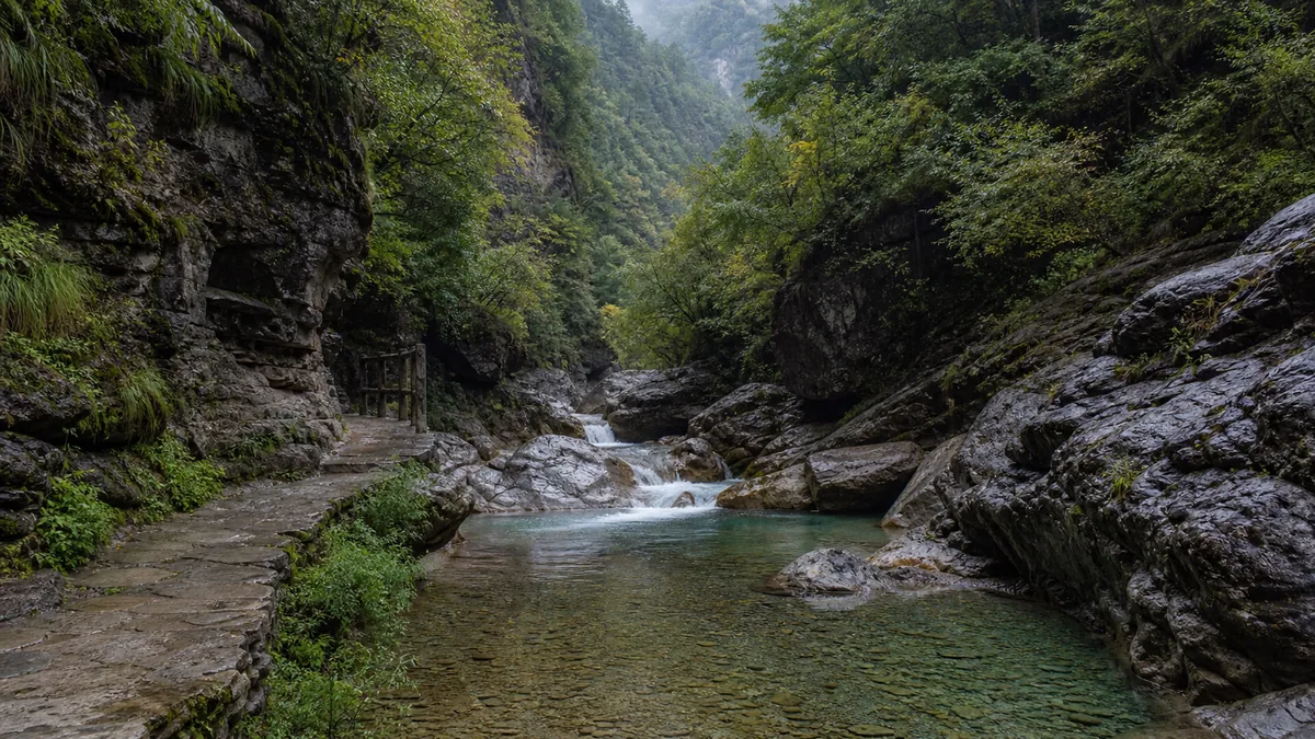
5A View location, maps and nearby scenic areasStand still where the stream tightens between rock walls and look downstream rather than up. The useful clue is not the waterfall in front of you but the narrow ribbon of space behind it: water, falling stone and repeated freeze–thaw have all worked inside the same mountain corridor. If you can hear a shuttle before you can see it, you also understand Guan’e Gou’s practical scale. This is a system of valleys, not a compact garden.
The scenic area lies in Tanchang County in Longnan, southern Gansu, outside the county seat. Its visitor identity normally centres on Guanzhugou and Eman’gou, with wider park descriptions sometimes naming additional valleys or high-country zones. Those labels do not guarantee that every sector is open, connected or included in one day’s transport. Start with the map issued for your actual visit.
Make one decision before counting sights: on a one-day trip, choose the valley with the best combination of open trail, manageable walking and reliable return transport. Treat a two-valley plan as two excursions unless the scenic area explicitly confirms a same-day link.
One scenic name, several mountain corridors
“Guan’e Gou” is an umbrella visitors encounter on tickets, maps and 5A listings. On the ground, Guanzhugou and Eman’gou have distinct approaches and internal sequences. A transfer between entrances may involve public road travel or a currently designated service; it should never be assumed from the apparent closeness of two lines on a tourism map.
Descriptions also change with planning phases. Older sources may mention Mulonggou, Miaogou, Leigushan or a through route, while a current notice may open only selected sections. Names can refer to a broad forest-park landscape, a managed scenic-area boundary, a shuttle stop or a promoted route—not necessarily the same thing. Ask three precise questions: which entrance is operating, where the last scenic bus returns, and whether any advertised cross-valley connection is running today.
This distinction saves time and improves the visit. Guanzhugou is often presented through a sequence of pools, gorge narrows and waterfalls. Eman’gou is often described through forest, moving water and a more sustained mountain walk. Neither formula is permanent. A closure can reverse which valley offers the fuller experience, and seasonal flow can change what each stop reveals.
Read the gorge before naming the view
Guan’e Gou sits in a complicated mountain transition near the eastern edge of the Tibetan Plateau, where branches of the West Qinling and Minshan systems meet. That regional statement helps explain steep relief; it does not date every cliff you see. At close range, use evidence that does not require a slogan: fractures divide the rock, angular debris collects below faces, and the stream occupies the lowest available line.
Where the walls pinch together, flowing water concentrates its cutting power. Where the valley widens, sediment can settle and vegetation finds a foothold. Some rock faces appear folded or strongly bedded; others are masked by soil, moss and trees. Follow official geological panels for the identity and age of a particular formation instead of turning every tilted layer into proof of one dramatic event.
Promotional names often compare the landscape with Jiuzhaigou. The comparison may help a first-time visitor imagine forested water, but it is not a geological classification and it creates the wrong promise of constant turquoise. Guan’e Gou deserves to be read on its own terms: narrower corridors, close rock walls, pools whose appearance shifts, and a route where transport logistics are part of the geography.
Lakes, pools and waterfalls are weather reports
Pause at one pool and move your head a step sideways. Reflected trees disappear, the bottom becomes visible, and blue may turn to green, brown or silver. Colour depends on sky, viewing angle, depth, suspended sediment, biological growth and the material beneath the water. A heavily edited photograph records one moment; it is not a contract with the next visitor.
The word “lake” is also used broadly on scenic maps. Some water bodies occupy natural depressions or are held behind accumulated debris; others may be influenced by small structures and routine management. Without a site-specific panel, do not assign every pool the same origin. What can be observed is the sequence: quiet water stores sediment and reflections, while a drop or constriction restores speed and sound.
Waterfalls are equally conditional. Rain and snowmelt can make them louder, but the same weather can trigger muddy water, flash-flood controls, falling rock and trail closure. A dry period can reduce a photographed curtain to separate threads. Never step beyond barriers to recover the “right” angle, and never enter a streambed because the current looks modest; rainfall upstream can arrive before the sky above you changes.
Forest, elevation and the sky above the trail
The lower journey moves through mixed mountain vegetation, while broader park descriptions extend to much higher ridges and alpine environments. Published maximum elevations usually describe an entire protected or administrative landscape, not the height an ordinary sightseeing route reaches. Do not use the highest number in a brochure to claim that every visitor has completed a high-altitude trek.
Even so, elevation matters. Air can feel cooler inside shade and near water; sun exposure rises when the canopy opens; a bus-assisted route may still end in prolonged stairs. Visitors arriving from a warm lowland city often underestimate the combination of temperature swing, thinner air at upper stops and accumulated walking. Carry a layer and water, pace uphill sections, and turn back for persistent headache, nausea, unusual breathlessness or poor coordination.
Forest is not a decorative frame around the water. Roots hold soil, dead wood shelters organisms, and leaf litter slows runoff. Stay on the hardened path, especially after rain. Picking plants, stacking stones, feeding wildlife or playing amplified sound replaces a living system with a visitor’s temporary arrangement.
A Longnan verse, not a Guan’e Gou legend
There is not enough secure evidence to attach a famous ancient poem specifically to these valleys. A more honest historical echo comes from Du Fu, the Tang poet whose work is valued for recording war, displacement and ordinary hardship. In 759, during the An Lushan rebellion, he lived briefly in Tonggu—modern Cheng County elsewhere in Longnan—then left with his family for Sichuan.
In Setting Out from Tonggu County, he wrote:
“I rein in amid Longtan’s clouds; turning my head, I look back at the white cliff.”
The line is regional, not site-specific: its Longtan and white cliff must not be relabelled as attractions inside Guan’e Gou. Its story matters because the mountain view is tied to compelled travel. Du Fu had hoped to stop, but insecurity and hunger forced another winter journey; looking back became both landscape observation and farewell.
The modern echo is quieter. Today’s visitor rides a maintained road, checks a shuttle and chooses a return time, yet clouds and cliff still control movement. A sudden closure can remind us that mountain scenery has never been merely a backdrop. Read the verse as a Longnan habit of seeing travel, weather and human limits together—not as proof that the poet stood at this pool.
Villages are communities, not scenery
Official interpretation and regional writing often discuss Tibetan and Qiang cultural presence in villages around the scenic landscape. Those descriptions should be attributed and handled carefully. Ethnic identity is lived, self-described and sometimes more complex than a tourism label. A roof shape, costume used for a festival or shop sign does not authorize a visitor to decide who someone is.
Residents may work as farmers, drivers, guides, shopkeepers, guesthouse hosts, craftspeople, teachers or students—often several roles across a year. Tourism can bring income and improved services, but it can also create traffic, waste, noise and pressure to perform a simplified version of culture. None of this means local traditions have “vanished,” nor that every resident follows the same customs.
Use ordinary guest etiquette. Ask before photographing a person, ceremony, domestic courtyard or religious object. Do not enter a house or field because a door is open. Buy food or craftwork because you value it, not as payment for an intrusive portrait. If a cultural presentation is scheduled, understand it as a contemporary, organised event rather than an untouched survival from the past.
Choose the route your body can finish
For one day, select one valley after checking current openings. Build the visit around a complete out-and-back or confirmed one-way sequence, keeping enough margin for the final bus. A photographed list of “must-see” stops from another year is less useful than the distance between today’s open drop-off points.
For two days, treating Guanzhugou and Eman’gou separately reduces transfer anxiety and leaves time to walk a short section rather than photographing from every bus stop. Ask whether a ticket remains valid across days, whether transport is charged or booked separately, and which entrance each day’s vehicle actually serves. These arrangements can change.
If arriving by air, rail or intercity coach, verify the whole last-mile chain to Tanchang and the chosen gate. Flights into the region may be limited, and an airport name containing “Longnan” does not mean it is beside the scenic area. Rail times, highway conditions, local buses and private transfers can all determine whether a same-day visit is realistic. Save the return plan offline; mobile coverage can weaken inside a gorge.
Weather, rockfall and accessible expectations
Read the forecast for Tanchang and the mountain area, then read the official closure notice on the morning of travel. Heavy rain can produce flash floods and debris flows; freeze–thaw, saturation and strong wind can loosen stone. After an earthquake or severe storm, barriers that appear inconvenient may be protecting against damage invisible from the path.
When thunder approaches, leave exposed viewpoints and follow staff directions. Do not shelter beneath an unstable overhang. Wear shoes with grip, keep both hands free on wet steps and give children direct supervision beside water. In cold weather, shaded paving can remain icy after sunny road sections have thawed.
Scenic buses make parts of the valley easier, but they do not make the whole destination step-free. Boarding heights, narrow bridges, gradients, stairs and wet surfaces can interrupt a wheelchair or stroller route. Visitors with limited mobility should ask staff which lower viewpoints, toilets and vehicles are accessible that day. A short lower-valley experience is a valid visit; no summit or final waterfall is required to understand the gorge.
Photograph the change, then hear the water again
For scale, place a bridge, railing or consenting companion near one edge of the frame rather than using extreme wide angle to exaggerate the cliff. At a pool, use a polarising filter cautiously: it can reveal the bed but remove the reflections that explain the forest. After rain, protect the lens and keep your feet on the path; the richest foreground is not worth trampling a bank.
Try a three-image sequence instead of chasing one postcard: the wide relationship between wall and stream, a mid-range view of water meeting stone, and a close detail of leaf, fracture or sediment. This records a system rather than pretending one colour defines Guan’e Gou. Drones, tripods and commercial filming may be restricted; check current rules and never fly over villages, wildlife or crowds without permission.
Before leaving, return to the opening exercise. Face downstream and listen. The water may be strong or slight, blue or opaque, but the narrow corridor still reveals the negotiation among rock, weather, forest and people. Guan’e Gou becomes memorable when it stops being a collection of promised waterfalls and becomes a mountain route whose changes you learned to notice.
Continue with the Guan’e Gou 5A profile, then compare other north-central China journeys at Kongtong Mountain, Mount Taibai and Famen Temple.
Location profile
Where it is

Frequently asked questions
Can I see all of Guan'e Gou in one day?
A focused day is usually better spent in one operating valley. Guanzhugou and Eman'gou have separate access and may require a road transfer; opening sections, shuttle links and last departures can change. Use two days if both valleys matter, and confirm the current map before arrival.
Should I choose Guanzhugou or Eman'gou?
Visitor accounts commonly associate Guanzhugou with a lake-and-canyon sequence and Eman'gou with a longer forest-and-waterfall experience, but the visible route depends on weather and current operations. Choose by open walking distance, shuttle service and your mobility rather than by an old attraction list.
When is the best time for lakes and waterfalls?
There is no guaranteed best date. Rain and snowmelt can strengthen streams but also raise the risk of flash floods, rockfall and closures; dry spells can reduce cascades. Autumn colour, clear water and snow views also vary each year. Check the forecast and official notices shortly before travelling.
Is Guan'e Gou accessible for visitors with limited mobility?
Scenic buses can reduce road walking, and some lower stops may be relatively level, but many rewarding sections include steps, gradients, wet paving and boarding gaps. Ask the scenic area which stops, toilets and vehicles are currently accessible, and plan a lower-valley visit with a companion if needed.