Shandong · Jining
Weishan Lake: Four Connected Lakes and a Working Wetland
Read the southern Nansi Lake system through shifting water levels, Grand Canal transport, wetland habitats, fishing labour and the layered memory of the Railway Guerrillas.
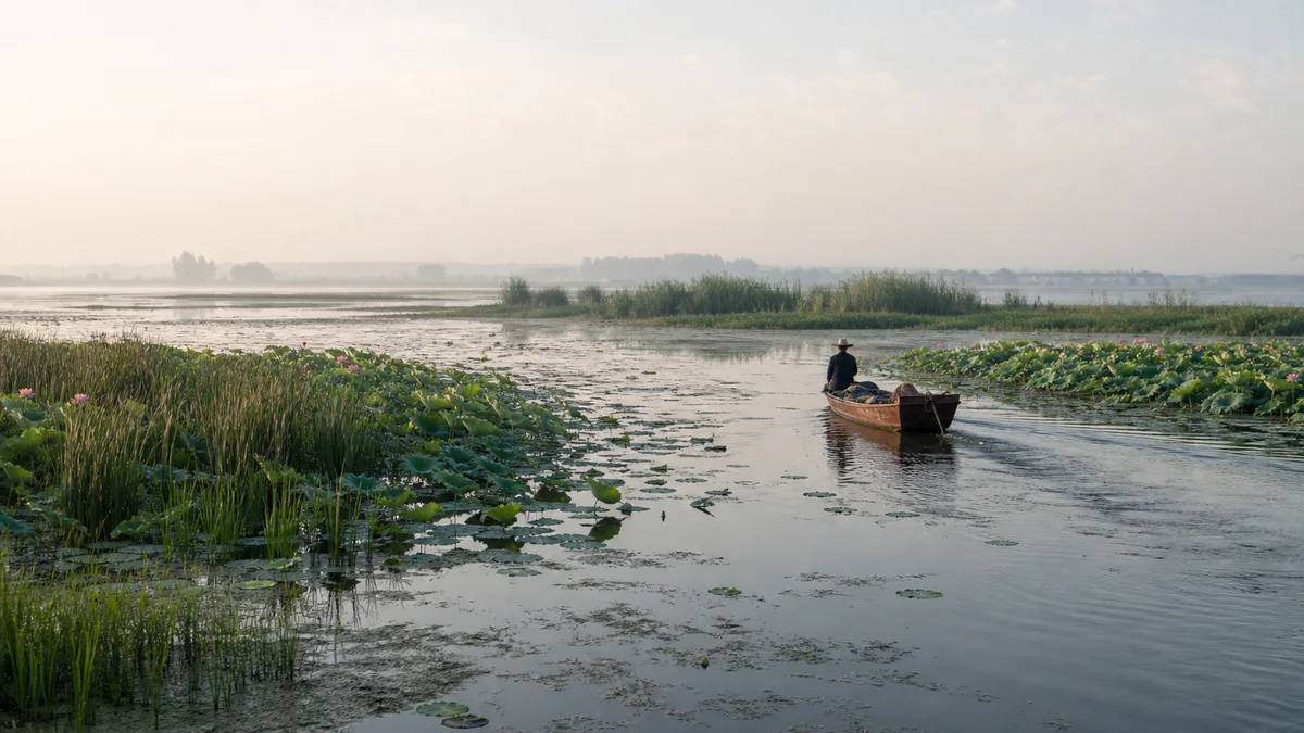
5A View location, maps and nearby scenic areasAt the pier, choose one fixed post, reed stem or stone edge and compare it with the waterline. The gap tells you what no lotus photograph can: this is a shallow, managed lake landscape whose shoreline, boat routes, mudflats and habitats change when the water rises or falls.
“Weishan Lake” is also a name used at more than one scale. It can mean the southernmost lake in a four-lake chain, the visitor zones around that lake, or—loosely—the wider southern Nansi Lake landscape. Before asking what you will see, establish which water, which shore and which pier your route actually uses.
Orient yourself through three lenses: shore and boardwalk routes reveal reeds, lotus and waterbirds; boat routes reveal channels, islands and the lake’s scale; village or memorial stops explain fishing, Grand Canal work and wartime memory. These experiences may begin at different access points and are not one guaranteed circuit.
One famous name belongs to a four-lake system
The Nansi Lakes, or “Southern Four Lakes,” form a connected shallow-water chain. From north to south they are Nanyang, Dushan, Zhaoyang and Weishan. Water, sediment and navigation connect them, but each name still matters. A tour sold as Weishan Lake may not cross the full system—and could not do so as a short scenic cruise.
These are not four deep bowls with permanent shorelines. River shifts, sediment accumulation, flooding, embankments and water engineering helped shape the lake complex over centuries. Its area and the distinction between open water, reed bed and exposed shallows vary with level and with the boundary used for measurement.
Weishan Lake lies at the southern end of the chain and is the focus of this guide. Treat the broader Nansi system as hydrological context, not as a claim that every attraction, island or wetland reserve can be visited from one gate.
Water level writes the day’s itinerary
Lake level responds to rain, inflowing rivers, evaporation and human management through gates, embankments and water allocation. No single cause explains every high or low season. A dry period can narrow channels and expose mud; a wet period can cover low paths, spread floating vegetation and alter safe landing points.
For ecology, neither “more water” nor “less water” is automatically better. Different birds, fish and plants need different depths and seasonal transitions. Sudden or prolonged change can disrupt nesting, feeding and spawning. Managers also balance flood safety, navigation, irrigation, water supply and habitat—needs that do not always align.
Read current conditions before choosing a route. A boardwalk may remain open when boats stop, or boat access may continue while a low wetland path closes. The lake is not failing to deliver the photograph; it is showing the condition that determines the whole system.
The Grand Canal used the lakes as transport infrastructure
The Beijing–Hangzhou Grand Canal passes through the Nansi Lake region. For imperial grain transport and later commerce, the lakes provided a north–south water corridor, but they were not an effortless highway. Crews faced wind, shallow water, silt, changing channels and the need for dikes, gates, dredging and local guidance.
Look at a channel as a piece of infrastructure. Markers, banks, landing points and controlled openings turned broad water into a route. Boatmen, pilots, repair workers, porters, clerks and families on shore made that route function. Official histories of grain quotas often hide the labour required to move one vessel across a variable lake.
Modern sightseeing boats borrow the canal’s low viewpoint but not its economic purpose. Their short loop cannot reproduce a cargo journey, and a staged boatman’s song is interpretation rather than proof of how every historical crew worked.
Lotus and birds follow seasons, not marketing calendars
Lotus is one of Weishan Lake’s most recognisable plants. It commonly flowers in summer, while leaves, seed heads and harvested products extend the visible cycle. Bloom timing and density respond to temperature, water depth, recent weather and local management. A broad green wetland without open flowers is not an “empty” lotus landscape.
Reed beds, shallow water, mudflats and open channels support resident and migratory birds. Species and numbers change through spring and autumn migration, wintering periods, breeding cycles and day-to-day disturbance. No boat operator can guarantee a particular flock close to the camera.
Use binoculars or a long lens, keep voices low and never use playback to draw birds towards you. Remain on boardwalks and designated routes; do not push a boat into nesting vegetation, pick flowers or stand on lotus beds. A close photograph is not worth a failed nest or damaged rhizome.
Fishing is skilled labour under real constraints
Lake communities have made livelihoods through capture fishing, aquaculture, lotus and reed products, transport, repair, farming and seasonal work. This is not a timeless life of drifting peacefully among flowers. Wind, cold, heat, equipment costs, uncertain catches, market prices and accidents shape the working day.
Fishing rules, closed seasons, protected zones and permitted gear change as managers try to sustain stocks and water quality. A net visible from a tour boat does not tell you whether it belongs to capture fishing, aquaculture or a demonstration. Ask before drawing conclusions—and before photographing a worker at close range.
Tourism offers additional income but also changes shore access, land values, waste and the demand to perform “fisherfolk culture.” A meal or demonstration can be enjoyable without pretending it represents every household. Ask where fish came from, respect prices as payment for labour and avoid pressuring residents to stage a net cast for free.
Railway Guerrillas: documented resistance and popular memory
During the war against Japan, Communist-led railway guerrilla units operated in southern Shandong around the Jinpu railway corridor and the Weishan Lake region. They conducted sabotage, intelligence, transport and liaison work, using railway knowledge, settlements and lake routes. Individual actions belong to a wider geography than today’s tourist boundary.
After the war, Liu Zhixia’s novel Railway Guerrillas and later film and television adaptations created a vivid popular narrative. Composite characters, compressed events and dramatic action made the history memorable but changed it. The famous song associated with the film is a work of screen culture, not an unedited field recording of guerrillas singing on a particular boat.
At a memorial, separate three questions: what archival sources document, what veterans and local communities remembered, and what novels or films created. All three influence cultural memory, but only the first two can support a claim that an event occurred at an exact place. Treat weapons, graves and casualty material with dignity; avoid mock-combat poses.
Choose shore, boat or island by your priority
For a wetland-focused half day, begin early on a boardwalk or shore route, when heat and disturbance may be lower. Spend time reading water depth, plant zones and bird behaviour. Add a short boat only if current conditions and mobility make it useful; the walk should still stand on its own.
For a history-and-community day, combine a lakeside or boat segment with a village, island or memorial stop whose current access you have confirmed. Travel between piers and land sites can consume more time than maps suggest. Do not assume one ticket or boat connects every named attraction.
For a seasonal lotus visit, ask for recent bloom information and choose a route with both open-water and planted-wetland views. Wind and midday glare can flatten the scene; an early start helps observation but does not guarantee flowers, birds or a specific boat channel.
Boats, weather and mobility set hard limits
Wind can build short, uncomfortable waves on a shallow lake, and thunderstorms or fog can change visibility quickly. Wear a life jacket as instructed, remain seated when required and do not lean out to reach lotus leaves. Carry sun protection, drinking water and a rain layer; shade on boats and exposed boardwalks may be limited.
Boarding can involve steps, gaps, changing ramp angles and wet surfaces. Ask the operator about current assistance and whether a wheelchair or stroller can be safely accommodated. A relatively level boardwalk can still have distant entrances, broken transitions or closed sections.
Confirm the exact departure pier, reservation or identification requirements, last return, parking or public transport and same-day weather notice through official channels. High or low water, vegetation clearance, maintenance and conservation closures can all change a route. Keep enough time that a delayed boat does not threaten an onward train.
Photograph the water condition, not an imagined idyll
Use layers to explain the lake: a water marker in front, reeds or lotus in the middle and an open channel behind. Photograph birds at a distance and working boats only with consent when people are identifiable. Do not crop away safety equipment merely to make labour look “traditional.”
At memorial sites, observe restrictions and caption staged scenes as reconstructions. At wetlands, no flash or drone image justifies disturbing wildlife or entering a protected zone. Avoid geotagging a sensitive nest location.
Before leaving, return to the fixed object you chose at the pier and look at the waterline again. The level has probably barely moved during your visit, yet now it contains four connected lakes, canal engineering, fish and bird habitat, uncertain labour and a history reshaped by popular storytelling. Weishan Lake is not most truthful when it matches a lotus postcard. It is most truthful when you can see why every changing centimetre matters.
The LoreLens app helps identify wetland zones, canal infrastructure and the boundary between wartime evidence and Railway Guerrilla popular memory at Weishan Lake.
Location profile
Where it is

Frequently asked questions
Is Weishan Lake one lake or part of a larger system?
Strictly, Weishan Lake is the southernmost of the four connected Nansi Lakes; from north to south the chain is Nanyang, Dushan, Zhaoyang and Weishan. In everyday tourism language, 'Weishan Lake' can also refer loosely to the wider southern lake landscape, so check which pier or zone a ticket names.
When can I see lotus flowers at Weishan Lake?
Lotus commonly blooms in summer, but the start, density and duration vary with temperature, recent weather, water depth and habitat management. Seed heads and broad leaves may outlast the peak flowers; check recent official conditions rather than booking for a guaranteed bloom.
Do sightseeing boats operate every day?
Do not assume so. Routes, piers and operating hours can change with wind, storms, fog, water level, aquatic vegetation, maintenance, seasonal demand and safety controls. Confirm the current official plan and keep a shore-based alternative.
Were the Railway Guerrillas a real wartime force?
Yes. Communist-led guerrilla units operated around the southern Shandong railway corridors and used the Weishan Lake area for movement, supply and support during the war against Japan. Later novels, films, television and songs reshaped that history, so a famous scene is not automatically a record of one exact lakeside location.