Xinjiang · Alar
Taklamakan and the 359th Brigade: How Alar Got There
A 5A scenic area in two halves—a reclamation museum in a city that did not exist in 1950, and a dune field 60 kilometres away. Between them: three glacier-fed rivers, a dried river bed, and a 3,046-kilometre tree belt.
5A View location, maps and nearby scenic areasThe city of Alar did not exist when the units that built it arrived. There was no town here in 1950, and the county-level city was not established until 2002.
That makes the place readable. Most Chinese 5A sites are old things with a fence around them; this is a rating over two separate sites documenting how a military formation became a farming organisation, and how that organisation became a city at the edge of China’s largest desert. The sequence is: a brigade number, a reclamation camp in Shaanxi, a march west, a demobilisation, three glacier-fed rivers, a river bed that dried for thirty years, and a tree belt that closed a 3,046-kilometre circuit in November 2024.
A 5A scenic area in two halves
The name suggests one place; the ticket covers two. Official descriptions give the Taklamakan · 359th Brigade Cultural Tourism Area as about 11.98 square kilometres. The larger part, roughly 7.68 square kilometres, is the 359th Brigade cultural zone in the city centre, on both banks of the Tarim River: static exhibits on the north bank—the reclamation museum, a monument, the Shanghai sent-down-youth memorial forest—and on the south bank a live-action performance venue plus study and training zones.
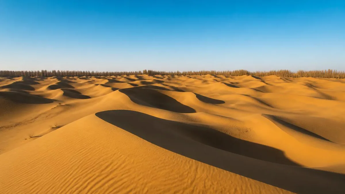
The other part, about 4.3 square kilometres, is the Taklamakan Desert Gate zone, out of town in the 11th Regiment’s Huaqiao town, on the desert’s northern edge and the Tarim’s southern bank. It is described in seven areas with fourteen activities, and works as a desert-recreation and motorsport site rather than a cultural one.
The Ministry of Culture and Tourism completed the public notice on 22 April 2021 and confirmed 5A on 11 May 2021, in the same batch as Sayram Lake. Travel sites still calling it 4A quote the previous status. Two zones, an hour’s drive apart—plan them as separate days.
What the 359th Brigade actually was
The lineage is documented well enough to write as a chain of events. In August 1937, at Zhuangli in Fuping County, Shaanxi, the Red Army’s Sixth Army Corps was reorganised together with parts of the 32nd Army and a headquarters special regiment into the 359th Brigade of the 120th Division of the Eighth Route Army—roughly 5,000 men, with a 717th and a 718th Regiment, a 719th added in early 1938. Chen Bojun was brigade commander and Wang Zhen his deputy; Wang Zhen is the name that stays attached to the unit, though accounts of when he took over as commander are inconsistent.
What makes the brigade unusual in the record is not its combat history but its second job: from 1941 it spent several years primarily farming, which is why the same formation was later sent to open land rather than hold ground.
The summary line used on site—born on Jinggangshan, grown at Nanniwan, fought across tens of thousands of li, reclaiming land at the Tian Shan—is a slogan that happens to be a fair précis.
Nanniwan, and the arithmetic behind a famous song
Nanniwan is the part most Chinese visitors arrive already knowing, because of a song. The underlying operation is documented in numbers worth reading as numbers. In March 1941, Wang Zhen led brigade headquarters, a replacement regiment, one battalion of the 719th and a special regiment into the valleys south of Yan’an—Jinpanwan, Linzhen, Mafang, Jiulongquan and Nanniwan—to open cultivation. Official histories record the brigade clearing about 11,200 mu, harvesting over 1,200 dan of fine grain and more than 1.64 million jin of vegetables, excavating around 1,000 cave dwellings, and reaching 78.5 percent self-sufficiency in funding.
Read those as what they are: figures from official accounts, internally consistent, not independently audited. The verifiable core is the shift in function. A combat brigade spent years as an agricultural unit, built the habits and the cadre for it, and became the obvious instrument when the same problem appeared two thousand kilometres west.
Wang Zhen left in 1944 to command a southward expeditionary column; the brigade’s units went through the Central Plains breakout before turning back northwest.
West in 1949, and a crossing that is retold more than it is measured
The march is where the retelling has outrun the sourcing, so separate what is dated from what is repeated. Dated: in March 1947 the formation was incorporated into the 2nd Column of the Northwest Field Army. In February 1949 it was reorganised as the 5th Division of the 2nd Army, 1st Corps, First Field Army, with 13th, 14th and 15th Regiments. By 22 December 1949 its units had reached the Aksu and Hotan areas of southern Xinjiang, and by March 1950 they were garrisoned across Kashgar, Hotan, Shufu, Aksu and Yanqi.
Repeated: that the advance covered about 2,520 kilometres and included a crossing of the Taklamakan. The crossing—a detachment walking from the Aksu side to Hotan in December 1949—is a real event, but the distance, the number of days and the number of men differ between accounts, sometimes substantially. Take the arrival date as firm, the crossing as attested, the figures as unsettled.
What matters for the landscape is the destination. These units did not arrive at farmland. They arrived at the northern rim of a sand sea, in a basin whose rivers ran full in summer and thin in winter.
1953: the year the uniforms came off
This is the hinge, and the date where sources contradict each other most. The broad account: in March 1953 the 5th Division was converted mainly to production work under a Xinjiang Military Region reorganisation, with some staff drawn off to form the Aksu military sub-district; in June 1953 the divisional designation was withdrawn and the unit reorganised as the First Agricultural Construction Division of the Xinjiang Military Region, its 14th Regiment becoming the division’s 1st and its 15th the 3rd. Several thousand officers and soldiers changed out of uniform. In 1954 the division was placed under the newly established Xinjiang Production and Construction Corps.
The disagreements are specific. Some accounts date the abolition of the divisional establishment to June 1952 and completion of the conversion to 1954; others give 5 June 1953 as the founding date of the First Division. Chinese sources flag the conflict themselves and defer to the division’s own gazetteer. Anyone quoting a single month is over-claiming.
One later date is clean: on 16 January 2013 the First Agricultural Construction Division was renamed simply the First Division.
Aral means river island, and the name is the explanation
The city’s name is a geographical description, and it explains the map. Aral is Uyghur for island, in the sense of the land a braided river leaves between its channels. That is the setting: the Aksu River out of the Tian Shan meets the Yarkand and Hotan rivers out of the Karakoram and Kunlun at Xiaojiake, inside the territory of the division’s 16th Regiment, and downstream of that junction the Tarim main stem begins. Alar is not near the head of China’s longest inland river. It contains it.
The administrative sequence is documented. Xinjiang requested the city in July 2002; the State Council replied that September—document Guohan (2002) 81—agreeing to a county-level Alar directly under the autonomous region, with an administrative area of 4,196 square kilometres. The first municipal people’s congress met in December 2002, and the city government was inaugurated on 19 January 2004. It runs on division–city integration: one apparatus, two identities, 17 regiment-towns.
Population figures need care. The 2020 census gives the city about 328,000 residents; a 2021 divisional figure about 438,600; a 2025 figure for the whole jurisdiction 573,500. These count different things, and the gap between them is not growth.
Why farming works here: the water
Rainfall does not explain this agriculture; the rivers do, and their behaviour is the constraint everything else is built around. All three headstreams are fed substantially by high-mountain snow and ice, so the basin’s water arrives in a summer pulse and thins in winter, stored in glaciers rather than in soil. The Tarim main stem below the junction is given as 1,321 kilometres; measured from the Yarkand as principal source, total length is given as 2,327 kilometres. Both figures circulate, and they measure different things.
Then the cost side, which belongs in the same section. Irrigated area on the three headstreams expanded from about 351,000 hectares after 1949 to about 777,000 hectares by 1995, with annual diversions reaching roughly 14.8 billion cubic metres—reported as 75.5 percent of the headstreams’ mean runoff. Downstream, the channel below the Daxihaizi reservoir ran dry from 1972; some 360 kilometres of bed and the terminal lake, Taitema, disappeared, and large areas of desert poplar along the lower corridor died.
The correction is documented too. A basin water-resources regulation—China’s first local law of its kind—came in 1997, and the State Council approved a comprehensive treatment plan in 2001 with 10.74 billion yuan attached. Ecological water conveyance to the lower Tarim began in 2000: by 2024 there had been 25 rounds, cumulative releases from Daxihaizi reported at roughly 9.8 billion cubic metres, and Taitema Lake holds water again. Transit time for the water head fell from over two months to about ten days by 2017.
Why farming works here: the sand
Water alone would not hold this land: moving sand would bury the canals, and that is the problem the tree belts address. The mechanism is worth stating plainly, because “holding back the desert” invites the wrong image. A shelterbelt is not a wall. It raises surface roughness, which cuts wind speed near the ground; below a certain speed the wind can no longer keep sand grains in transport, so they drop out among the plants instead of arriving in a field or a channel. The species used are the ones that tolerate the conditions—desert poplar, saxaul, tamarisk—and newer sections are irrigated by water-saving systems, a reminder that a planted belt here is infrastructure with a running cost.
The scale is unusual. Planting around the Taklamakan dates from the Three-North shelterbelt programme launched in 1978. By the end of 2023 the belt measured about 2,761 kilometres, leaving a final gap reported at 285 kilometres; that gap was closed on 28 November 2024 with the last planting in Yutian County on the southern rim, completing a circuit given as 3,046 kilometres around a desert of some 337,600 square kilometres. Chinese official reporting calls it the world’s longest green barrier around a desert; independent coverage repeats the figures with minor rounding differences.
What that protects here is a quantified agriculture. Published 2024 figures give more than 2 million mu of cotton—about 90 percent of it a locally bred variety with fibre reported above 30 millimetres—plus 820,000 mu of grain producing 468,000 tonnes, and around 1 million mu of cumin yielding 55,000 tonnes, described as half the Corps’ area and about two-thirds of its output. Cotton area was down 60,000 mu that year, converted to grain. The climate explains the crop choice: annual mean near 10.7°C, a frost-free period near 220 days, over 2,900 hours of sunshine.
What there is to see, and what it costs
Only one of the two zones is weatherproof. The 359th Brigade Reclamation Memorial Hall is the anchor. Construction began in July 2006 and it opened on 26 September 2009, on a site of about 35,000 square metres with roughly 11,000 square metres of floor area in seven zones. National heritage administration data for 2022 give it 12,923 catalogued items and 235,663 visitors. It holds several national education-base designations and entered the national red-tourism directory in December 2016. Admission is generally described as free with advance booking; it sits on Junken Avenue in the city centre.
Also in the city zone: a reclamation monument, a live-action performance on the south bank, and the Shanghai sent-down-youth memorial forest. That has a documented basis—between July 1963 and July 1966 Shanghai sent over 100,000 young people to Xinjiang, of whom this division is recorded as receiving 45,402, about 47 percent of the Corps total.
The Desert Gate zone is the outdoor half: camel riding, off-road vehicles, karting, a spring-fed water area expanded in a 2025 upgrade, and an RV campsite. It became a national sports-tourism demonstration base in November 2021. A notice effective 10 June 2025 set admission at 60 yuan per person with half-price and exemption categories; private cars are not admitted inside.
One archaeological note, often mis-summarised: the Kungang tomb groups in the 11th Regiment’s territory have produced radiocarbon dates spread across roughly 4,600, 4,300, 3,800, 2,600, 1,200 and 900 years before present. A single “3,000 years old” caption does not describe this site; the spread is the finding.
Before you leave, go and look at the edge
Do one thing at the Desert Gate that the activity list does not sell. Walk to where the last irrigated ground stops and stand on the line.
On one side there is a canal, a windbreak of poplar or tamarisk, and a field. On the other, sand with nothing in it. The line is neither natural nor permanent: it is the current position of an argument between three glacier-fed rivers, decades of engineering and the prevailing wind, and it has moved both ways within living memory—badly downstream after 1972, back again since 2000.
That is what makes this scenic area worth two days. The museum in town explains why anyone came; the dune field explains what they were up against. Between them lies a river over-drawn until it dried for thirty years and now dispatched by regulation, and a planted circuit 3,046 kilometres long that closed in 2024.
A city appeared here in 2002 because that combination held. It holds by maintenance rather than conquest, and standing on the line is the fastest way to see the difference.
The LoreLens app can help you identify shelterbelt species, dune forms and riparian poplar while explaining the engineering behind the oasis edge.
Location profile
Where it is

Frequently asked questions
What is the Taklamakan · 359th Brigade Cultural Tourism Area, and is it one place?
It is one rating covering two separated sites in Alar, the city administered jointly with the First Division of the Xinjiang Production and Construction Corps. Official descriptions give the whole scenic area as about 11.98 square kilometres, split between a 359th Brigade cultural zone of about 7.68 square kilometres in the city centre, on both banks of the Tarim River, and the Taklamakan Desert Gate zone of about 4.3 square kilometres on the desert's northern edge in the 11th Regiment's Huaqiao town. The Ministry of Culture and Tourism completed its public notice on 22 April 2021 and confirmed 5A status on 11 May 2021, alongside Sayram Lake. Some travel sites still describe it as 4A; that predates the upgrade.
Who were the 359th Brigade, and which dates are actually firm?
The firmest points are the endpoints. The brigade was formed in August 1937 in Fuping County, Shaanxi, from the Red Sixth Army Corps and other Red Army units as a brigade of the Eighth Route Army's 120th Division. From March 1941 it carried out large-scale land reclamation around Nanniwan south of Yan'an. In February 1949 it was reorganised as the 5th Division of the 2nd Army, First Field Army, and in December 1949 its units reached the Aksu and Hotan areas of southern Xinjiang. In 1953 the division was converted to production work and became the First Agricultural Construction Division of the Xinjiang Military Region, entering the newly formed Corps in 1954. The 1953 sequence is where accounts disagree—March, June, or a two-stage process running into 1954 all appear—and intermediate command changes are reported inconsistently. Treat the chain as solid and individual months as approximate.
How is intensive farming possible on the edge of the Taklamakan?
Two things make it work, and both are engineered. The water is not local rainfall but snow and glacier melt: the Aksu River from the Tian Shan and the Yarkand and Hotan rivers from the Karakoram and Kunlun converge inside Alar's territory at Xiaojiake to form the Tarim main stem, given as 1,321 kilometres long. The sand is held back by shelterbelts. Planting around the desert began with the Three-North programme launched in 1978; by the end of 2023 a green belt of about 2,761 kilometres had been assembled, and on 28 November 2024 the last gap was closed, completing a belt reported at 3,046 kilometres around a desert of some 337,600 square kilometres. Shelterbelts work by cutting near-surface wind speed so that moving sand drops out before it reaches canals and fields, rather than by stopping the desert as a wall.
When should I go, and can I get into the desert?
May to October is the usual window for the desert zone, because sand activities depend on heat and wind. The reclamation museum is generally described as free with advance online booking, sited on Junken Avenue in the city centre, and it is indoor—so it works in weather that shuts the dunes. For the Desert Gate zone, a notice effective 10 June 2025 put admission at 60 yuan per person, with half-price and exemption categories, and private cars are not admitted inside. Which desert routes, camps and vehicle activities are running changes with season, weather and the 2025 upgrade works, and dust storms close things without notice. Everything in this paragraph is exactly the kind of detail that moves; confirm with the scenic area rather than an itinerary written last year.
Sources and further reading
Background references for the history and place names in this guide. Opening hours, ticketing and access change often — always confirm with official local information before travelling.