Hebei · Hengshui
Hengshui Lake: Reading a Living Wetland on the North China Plain
Slow down among open water, reeds and mudflats at Hengshui Lake, then learn how migration, managed water, restoration and nearby communities keep this protected wetland alive.
5A View location, maps and nearby scenic areasReach the reed edge, stop talking and wait one minute. A ripple separates from the wind, a small bird climbs out of the stems, and a distant flock changes direction. At Hengshui Lake, distance is part of how a wetland protects life.
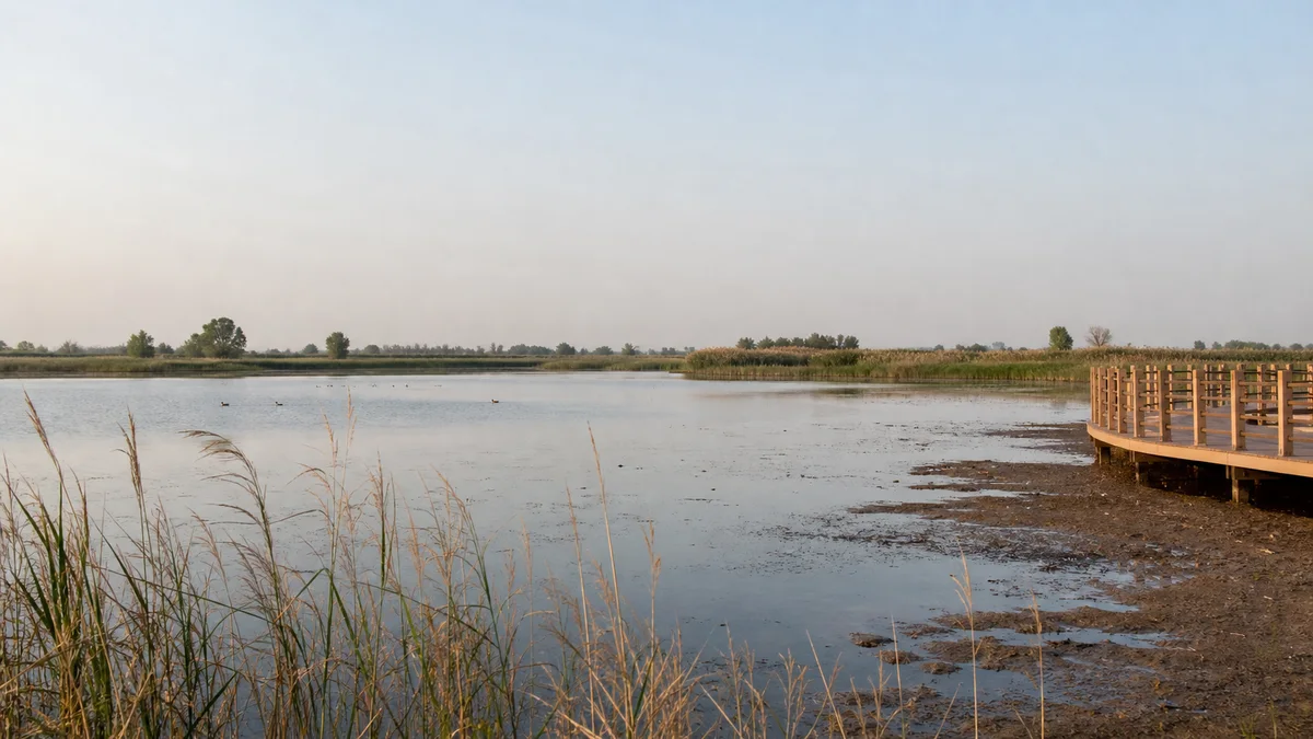
Hengshui Lake, in the city of Hengshui on the North China Plain, is both a managed water body and the centre of a nationally protected freshwater wetland. Open water, reed marsh, mudflat, meadow and woodland form a mosaic kept functioning by water, people and rules.
Start with the Hengshui Lake 5A scenic-area profile for location and coordinates. At the entrance, use the current visitor map to identify legal observation areas. A tourism title describes service quality in the visitor zone; it does not turn a nature reserve into an unrestricted park.
Three boundaries explain the confusing numbers
Official Hebei environmental information gives the Hengshui Lake National Nature Reserve a total area of about 163.65 square kilometres. A later local government account describes the lake—the reserve’s principal water body—as roughly 75 square kilometres, divided into eastern and western waters by an artificial dyke. The tourist scenic area has its own managed footprint.
These figures answer different questions. The reserve includes marsh, seasonal shallows, mudflat, meadow, woodland and management zones beyond permanent water. The 75-square-kilometre figure is a management-scale water area, not a fixed shoreline. Rain, evaporation, replenishment and operating levels move the edge.
Do not use a boat map as a reserve map. Some sectors may close to reduce disturbance even when water appears reachable. Official signs define where visitors may go.
A shallow basin shaped by rivers and water control
Hengshui Lake occupies a shallow depression with a history linked to shifting courses and sediments of regional rivers. Local official accounts describe traces associated with ancient channels of the Yellow, Zhang, Hutuo and Fuyang river systems. That does not make every present shoreline ancient: dykes, gates, drainage, diversion and modern management now strongly influence the water body.
Because the basin is shallow, a modest level change can expose broad mudflat or flooded vegetation. “Less lake” may feed some waders, while prolonged shortage shrinks marsh function. One fixed depth would not serve every plant, fish and bird; timing, water quality and habitat diversity matter.
Evaporation can exceed precipitation, and the lake lacks a large dependable river inflow. Managed replenishment is therefore central. Regional channels, including Yellow River diversion routes in some years, transfer varying volumes. A full-looking lake may reflect costly upstream coordination, not abundant natural supply.
Migration turns empty water into a network
Hengshui Lake is an important stop, breeding area and winter habitat for waterbirds. Government surveys record hundreds of bird species, but totals change with survey years and taxonomy. A cumulative list is not one morning’s checklist.
Look for behaviour before names: ducks feeding in open water, herons at reeds, shorebirds probing mud. A flock repeatedly lifting may signal a raptor, boat, loud group or photographer. Consider disturbance.
The critically endangered Baer’s pochard is documented here and has focused research attention, yet it is not a promised attraction. Report useful sightings through appropriate channels, but do not broadcast a nest or roost location.
Spring and autumn bring migration changes; winter and breeding seasons reveal other communities. Timing shifts with temperature, ice and water level. Ask what was observed recently, then accept that a common coot may be the day’s best teacher.
Protection came in stages, not with the 5A sign
Hebei approved a provincial wetland-and-bird reserve here in 2000, and the site became a national nature reserve in 2003. Management later moved from basic pollution control towards monitoring, habitat work and more formal regulation. The provincial Hengshui Lake Protection and Governance Regulations took effect in 2022, adding a legal framework for ecological water and protection responsibilities.
The Ministry of Culture and Tourism formally added Hengshui Lake tourist scenic area to the national 5A list on 27 December 2024. That designation is recent, but it did not create the wetland’s ecological value. It recognises a tourism operation inside a landscape already governed by conservation history.
Visitor centres, greenways and interpretation can make conservation visible and fund work. More visitors also bring traffic, noise and demand for closer views. Ask whether each facility keeps disturbance within ecological limits.
Water restoration changes livelihoods as well as habitat
Restoration has blocked pollution, removed some enclosure aquaculture, restricted fishing or navigation in sensitive water, restored shoreline, managed vegetation and replenished water. Fishers, farmers, residents, wardens, researchers and tour workers experience different costs and benefits.
Official accounts describe ecological compensation for reserve farmland and less damaging livelihoods. Birds cannot be protected by quietly transferring every cost to nearby communities. “People, birds and lake in peaceful coexistence” is a management goal, not a finished condition.
Replenishment can prevent contraction, but transferred water involves upstream demand, energy, infrastructure and water-quality questions. Volume alone is not success; timing, entry point and habitat response matter.
Notice a ranger keeping people out of reeds, a technician reading water or a cleaner removing litter. This self-contained-looking wetland depends on agreements beyond the horizon.
Build a route around habitats, not attractions
Begin at the interpretation or education centre if open. Learn accessible zones and recent observations, choose one authorised waterside or boardwalk route, then wait at a fixed viewpoint without blocking others.
Give that viewpoint at least ten quiet minutes. Changes in light, water movement and bird behaviour often reveal more than another hurried transfer.
If time is short, choose one habitat transition—woodland to reed, reed to open water, or shallow edge to mudflat—and walk slowly. Half a day can beat a full day of transfers.
Boat trips reveal open-water scale when operating, but are not automatically the best birdwatching platform. Noise, route and seating affect observation; conservation closures take priority. Confirm departure, return and photography rules.
Lotus flowers, sunrise reflections and large bird gatherings are seasonal or weather-led, not scheduled shows. Opening hours, admission, boat routes, vehicle access and observation sectors can all change. Use the scenic area’s official channel and on-site notices rather than an old itinerary.
Boardwalk comfort does not remove wetland risk
Flat does not mean effortless. Exposed paths have little shade; summer brings sun, heat, insects and storms. Carry water, sun protection and suitable repellent. In cold months, open water amplifies wind and boardwalks may become slick.
Stay on constructed paths. Mud can be deeper than it looks, reed beds obscure water edges, and banks can collapse. Do not step around a barrier for lotus photographs or retrieve dropped equipment yourself. Ask staff for help.
Step-free sections may exist, yet transport gaps, thresholds, viewing-slot height, toilets and boat boarding can remain obstacles. Ask which route is continuously accessible today, not whether the site is broadly labelled accessible.
Emergency, boat and conservation operations can alter the route without notice. Keep children close beside water and never fly a drone unless current rules explicitly permit it; the noise and silhouette can disturb birds far beyond the launch point.
Watch quietly and photograph the habitat
Binoculars may improve the visit more than a larger camera. Scan near water, reed edges and distant open water, then hold still: concealed birds reveal themselves through movement.
Use a long lens from an authorised point and leave room around the bird. Alarm calls, vigilance or retreat mean stop approaching. Never chase, play calls, feed birds or ask a boat to close the distance; feeding changes behaviour and water quality.
A strong image need not feature rarity. Show a bird within reeds, the mud–water line or people behind a boundary. Morning light and reflections are not guaranteed; midday heat haze can express depth.
Avoid publishing precise nest locations. Ask before closely photographing fishers, wardens or residents, and do not treat working boats as props. The ethical distance that limits a portrait may also be the ecological distance that lets a bird keep feeding.
Leave before the lake looks “complete”
Return to the reed edge at the end. It will not look complete, because a wetland never presents all its layers at once. Water hides mud; reeds hide nests; migration carries birds onward; a closed sector protects activity you may never see.
Hengshui Lake is neither untouched nature nor merely engineered water. River history formed a low basin, while dykes and transfers now help hold water. Protection has restored habitat and restricted damaging uses, while communities continue to negotiate what conservation requires. The new 5A status adds another layer of access and responsibility.
Leaving a distant bird distant is not a missed opportunity. It means the lake has retained enough space for another life to continue its route.
Compare this managed plain-lake wetland with the much larger reed-and-water landscape of Baiyang Lake, where boundaries, hydrology and community life take a different form. For a historic urban contrast, walk the walls and waterways of Guangfu Ancient City.
LoreLens App can help identify Hengshui Lake’s wetland features on site, then explain how water management, migration and human choices shape what you see.
Location profile
Where it is

Frequently asked questions
Is Hengshui Lake scenic area the same as the national nature reserve?
No. The national nature reserve, the lake's water surface and the managed visitor area have different boundaries. Official sources commonly give about 163.65 square kilometres for the reserve and about 75 square kilometres for the main water body, while water level and surface extent can vary. A 5A ticket or map does not grant access to every protected zone.
Which birds will I see at Hengshui Lake?
Hundreds of bird species have been recorded across years of surveys, and the wetland is an important migration, breeding and wintering habitat. No particular species is guaranteed on one visit: season, water level, weather, time of day and disturbance all matter. Use a long lens or binoculars and accept distance rather than chasing a sighting.
Can I take a boat and walk every boardwalk at Hengshui Lake?
Boat routes, docks, observation areas, boardwalks and lotus-viewing zones may open, change or close according to season, water conditions, conservation needs, maintenance and safety. Check the official scenic-area notice on the day and plan a rewarding shore-based route in case water access is unavailable.
How long should I allow for a first visit?
Allow half a day for an interpretation centre, one quiet wetland walk and patient observation from an authorised viewpoint. Add time only after confirming current transport and boat operations. Summer heat and exposed paths slow the pace, while serious birdwatching may reward a longer, quieter visit rather than more attractions.